28 Jun 2026 9 min to read
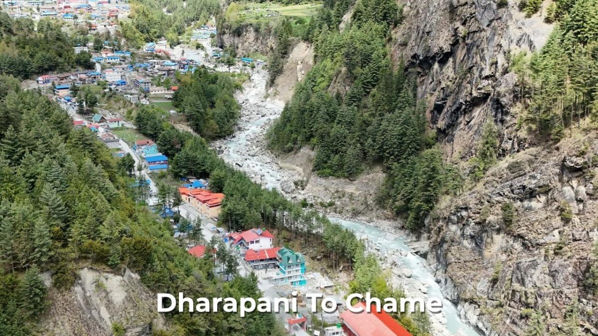
The Dharapani to Chame Trek route is one of the most beautiful parts of the Annapurna Circuit Trek. Normally, this is the third day of your Annapurna Circuit Trek package itinerary offered by Nepal Holiday Trip. Trekkers go deeper into the High Himalayan section into the Manang District. This Annapurna Circuit Trail introduces dramatic Himalayan scenery, dense pine forests, traditional villages and magnificent views – all of which define the classic Annapurna Circuit Trek experience of Nepal.
On this day, trekkers leave Dharapani and gradually ascend through beautiful villages like Bagarchhap, Timang and Koto. In Koto there is a checkpoint for your documents like permits, then hike another half hour to reach Chame. Chame is the administrative headquarters of Manang District, where all government official work runs from. This part of the Annapurna Circuit Trek combines moderate elevation gain with rewarding landscapes, making it one of the most enjoyable days on the trek.
Dharapani to Chame Distance
The trek from Dharapani to Chame covers a walking distance of approximately 15 kilometres. For this distance, usual walkers take about 6 to 7 hours, depending on pace and trail conditions. This part of the popular Annapurna Circuit Trek follows the Marsyangdi River Gorge, passing through beautiful pine forests, crossing suspension bridges and passing through traditional villages like Timang and Bagarchap. As you gain higher altitude, the landscape gradually transitions from subtropical vegetation to alpine scenery. From this route, you will see Annapurna and Lamjung Himal.
Dharapani to Chame Trek Route
The typical Annapurna Circuit Trek route for this day follows: Dharapani → Bagarchap → Timang → Koto → Chame
This route passes through traditional Tibetan-influenced villages, pine and fir forests, waterfalls and many scenic viewpoints. Each segment offers unique landscapes and cultural encounters, making the journey to Chame both rewarding and unforgettable.
Dharapani to Bagarchap
- Starting elevation: 1,960m → Ending elevation: 2,160m
- Elevation gain: +200m
This initial section features a gradual uphill climb through forested trails and small settlements. The 200-meter elevation gain is so gradual that it serves as a perfect warm-up and transition day for your body to adjust comfortably to the changing altitude without feeling overly exerted.
Major Highlights of Dharapani to Bagarchap Route
This part of the trek feels truly magical, acting as a gateway to a whole new world. As you walk, you will notice Tibetan-style houses with flat roofs alongside traditional Gurung houses, colourful prayer flags dancing in the wind, and a natural scenery that changes beautifully with every step.
Tips for Dharapani to Bagarchap
Stay properly hydrated right from the very start of the trek – drinking water helps your body continuously adjust to the thinner mountain air. The trail is gentle and pleasant, making the 200-meter elevation gain feel very smooth.
Bagarchap to Timang
- Starting elevation: 2,160m → Ending elevation: 2,750m
- Elevation gain: +590m
This is the most demanding and physically challenging section of the whole day, featuring a steep uphill climb. Before arriving at the village of Timang, the track winds its way up through deep, thick forests.
Major Highlights of Bagarchap to Timang Route
As you walk this section, the views open up to the grand scale of the Himalayas. You are treated to breathtaking, clear views of the towering peaks of Mt. Manaslu and Lamjung Himal dominating the skyline. Along the way, you will pass through authentic traditional mountain villages complete with stone houses and a peaceful pace of life.
Tips For Bagarchap to Timang Route
This is the steepest part of the day, so take your time. Stay hydrated and pace yourself steadily through the forested climb to avoid burnout before the day ends.
Timang to Koto
- Starting elevation: 2,750m → Ending elevation: 2,610m
- Elevation change: -140m
The trek from Timang to Koto is a welcome relief – you will actually be heading downhill, giving your lungs a break with a steady descent. Even though you are descending, the high altitude means the air is still thin, so walk slowly to preserve your energy and protect your knees. Use trekking poles for extra support and stability on the downhill stretches.
Major Highlights of Timang to Koto Route
- Scenic forest trails
- River valley views
- Peaceful trekking environment
Tips For Timang to Koto Route
Even on downhill sections, take brief breaks whenever needed. Be mindful of unexpected uphill climbs along the way. Trekking poles provide excellent support and reduce strain on your knees.
Koto to Chame
- Starting elevation: 2,610m → Ending elevation: 2,670m
- Elevation gain: +60m
The trek from Koto to Chame is a short and easy transition hike with a modest elevation gain of approximately 60 meters. This allows you to settle into a comfortable, steady walking rhythm. Enjoy the peaceful forest views, but watch your step on uneven parts of the path. Carry snacks to keep your energy levels high, as facilities can be limited on this stretch. Surrounding peaks and rocky cliffs become increasingly visible as you approach Chame.
Major Highlights of Koto to Chame Route
- Gateway to the higher Manang region
- Spectacular mountain landscapes
- Traditional architecture and local culture
Tips For Koto to Chame
This is the final push of the day – take it steady and enjoy the scenery. Carry enough water and snacks as the section is short but still requires energy after a full day of trekking.
Total Elevation Profile: Dharapani to Chame
- Total net elevation gain: 710 meters
- Start: 1,960m | End: 2,670m
While the overall trek is an ascent, the terrain includes a short downhill dip of about 140 meters between Timang and Koto before the final 60-meter incline into Chame. Your legs will actually climb a total of 850 meters due to the rolling terrain.
Dharapani to Bagarchap: +200m – Thick forest with easy warm-up.
Bagarchap to Timang: +590m – The most demanding section, featuring a steep uphill climb.
Timang to Koto: -140m – A welcome relief with a steady descent.
Koto to Chame: +60m – A gradual final walk to finish the day.
Difficulty Level of Dharapani To Chame
The Dharapani to Chame section is generally considered a moderate trekking day on the Annapurna Circuit Trek. While the trek does not involve any technical climbing, the elevation gain and 6–7 hours of walking require a reasonable level of fitness. Most trekkers find this day manageable because the trail is well-maintained and passes through several villages where rest stops are available. Altitude begins to play a more noticeable role as trekkers enter the Manang region.
Factors Contributing to Dharapani To Chame Difficulty
The primary challenge is the continuous uphill section between Bagarchap and Timang, which requires physical exertion early in the day. The total walking time of around 6–7 hours is made more demanding by the uneven stone and forest trails underfoot. Altitude increase also adds to the physical challenge as the day progresses.
Accommodation in Chame
Chame serves as the administrative center of Manang District and offers some of the best facilities at this early stage of the Annapurna Circuit Trek. Trekkers can find teahouses, lodges and guesthouses that provide clean rooms with attached or shared bathrooms, charging facilities, dining halls, Wi-Fi and a variety of meal options. Since Chame is a popular overnight stop, booking through a trekking package like Nepal Holiday Trip ensures your accommodation arrangements are taken care of.
Best Time for Dharapani to Chame Hike
The best seasons for the Dharapani to Chame hike are Spring (March to May) and Autumn (September to November). During these times, trekkers enjoy stable weather, clear mountain views, excellent trail conditions and comfortable temperatures.
In Spring, rhododendron forests are in full bloom with vibrant landscapes, while Autumn offers crystal-clear Himalayan panoramas following the monsoon season. Winter trekking is possible but colder temperatures and occasional snowfall make the journey more challenging.
Major Location Highlight and Cultural Experiences In Dharapani To Chame Route
Traditional Tibetan-Influenced Villages
The journey from Dharapani to Chame is deeply enriched by authentic Himalayan culture and Buddhist influence along the route. As you trek, you will pass prayer flags fluttering in the mountain breeze, intricately carved mani walls, and traditional stone architecture that reflects the rich heritage of the region. The trail brings you into close contact with local Gurung, Tibetan and Manangi communities – mountain residents renowned for their warm hospitality, offering trekkers a genuine glimpse into their traditions and way of life.
The natural landscape along the way is nothing short of spectacular, highlighted by the dramatic Marsyangdi River Valley. Arriving in Chame marks your official transition into the gateway of the higher Manang region – a milestone that signals the beginning of the dramatic, high-altitude landscapes and deep cultural richness that have made the Annapurna Circuit Trek famous worldwide.
Frequently Asked Questions About Dharapani to Chame Route
How tough is the Dharapani to Chame route?
The route is considered moderately difficult. Trekkers walk for around 6–7 hours with gradual altitude gain and several uphill sections, particularly between Bagarchap and Timang.
Do you need a permit for the Dharapani to Chame route?
Yes, all trekkers need the Annapurna Conservation Area Permit (ACAP) and TIMS Card for this section of the trek.
What are the major highlights along the Dharapani to Chame route?
Major highlights include the Timang viewpoint, Tibetan cultural influences, the Marsyangdi River Valley, traditional mountain villages, pine forests and beautiful Himalayan views.
Is food and accommodation available along the route?
Yes, food, teahouses and accommodation are available at Dharapani, Bagarchap, Timang, Koto and Chame, making this a comfortable route for trekkers.
Which season is best for the Dharapani to Chame route?
All seasons are possible, but Spring (March–May) and Autumn (September–November) provide the best trekking experience with optimal weather and trail conditions.
Last updated on 28 Jun 2026
Dhruba Bhatta