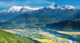
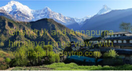
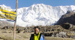
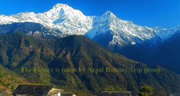
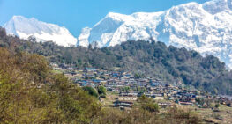
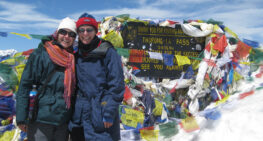
The Annapurna Circuit trek is one of the most well-known trekking routes in Nepal. It is known for its diverse landscapes, cultural richness, and high-altitude adventure. Annapurna Circuit Trek has diverse landscapes, cultural richness, and high-altitude adventure. It circles the Annapurna massif, passing through deep valleys, alpine deserts, alpine forests, and high mountain passes.
About the Annapurna, before the 1970s, the Annapurna region was largely isolated, with only local traders and pilgrims traveling through its valley. In 1950, Maurice Herzog’s French expedition became the first to successfully climb Annapurna I (8,091m), the first 8-thousand-meter peak summited. The trek became accessible to foreigners in the late 1970s. After that Annapurna region trek became famous among trekkers worldwide.
Evolutions of the Trek- In the 1980s and 1990s, the trek gained global popularity due to its diverse landscapes and cultural experiences. The construction of teahouses and lodges made it more accessible, reducing the need for camping. With the development of roads, some parts of the trek have changed, but it remains one of Nepal’s best trekking routes.
Total Distance 160- 230 kilometers, depending on the trip’s starting point the ending point.
Highest point: Thorong La Pass (5,416m/17,769ft)
Region Covered: Lamjung, Manang, Mustang and Myagdi District
Major Rivers: Marsyangdi River on the eastern side and Kaligandaki River on the western side of the Thorong La pass.
Trip Highlights
-World’s Deepest gorge- Kali Gandaki between Annapurna and Dhaulagiri Mountain.
-Diverse climate zones- Ranges from Tropical forests to alpine deserts.
Culture and People
The Trek passes through Gurung, Magar, Tamang, Thakali, and Tibetan-influenced communities. Buddhist Monasteries, prayer Flags, and Chorten are common in the walking path and the Annapurna region trail. Muktinath Temple, at 3,800 meters, is a sacred Hindu and Buddhist pilgrimage site.
Why is the Annapurna Circuit Trek famous?
One of the World’s greatest trekking Routes, which offers stunning scenery and cultural immersion
Varied landscapes from subtropical forests to high mountain deserts.
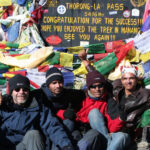
The challenging and Rewarding trek crossing Thorong La Pass is a major achievement.
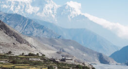
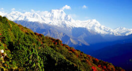
The Annapurna Circuit trek is a long-distance trek that encircles the Annapurna Massif. It is known for its dramatic landscapes, high mountain passes, and diverse cultural experiences. The Annapurna round trek passes through lush subtropical forests, terraced fields, alpine meadows, and arid high-altitude deserts, giving trekkers a chance to experience a wide range of scenery and climates .
The Annapurna Circuit trek walking distance is about 160 to 230 kilometers. Trekking time will be about 10 days to 3 weeks, depending on how far you would like to drive to start the hike. The maximum elevation is 5,416m (17,769ft) at Thorong La Pass.
The best time for this trek will be from March to June and September to mid-December. And the level of trekking is moderately challenging. If you train well before you come to Nepal for trekking, it will be easy and success the trip.
-starting and ending points: The trek typically starts in Besisahar and drives to Dharapani, 1900 meters. If you have a shorter time and want to complete the Annapurna Circuit Trek, you can drive up to Chame at 2700m. The trek will end at Muktinath, and the next day, drive to Tatopani at 1400 meters and trek to Ghorepani. The next day, walk down to Ullery and drive back to Pokhara.
– Geographical and climate variations: The Trek Covers Five Climate Zones
1. Tropical/Subtropical Zone below 1,500 meters -Lush Green forests, Terraced Fields, and Warm Weather
2. Temperate Zone 1500m to 2,500 m. – Pine and oak forests with moderate temperatures.
3. Subalpine Zone 2,500m to 3,500 m- Cooler climate, Rhododendron forests, and alpine meadows.
4. Alpine Zone 3,500m-5000m – Barren Landscapes, Rocky terrain, and High-altitude vegetation.
5. Arid Trans Himalayan Zone above 5000m- Dry, desert-like terrain similar to Tibet, especially in the Manang and Mustang regions
-Marshyangdi River Valley: The Trek follows this river for most of the early part, offering stunning valley views.
-Manang 3500m: A Beautiful Himalayan Town, a crucial acclimatization stop, with side trips to Ice Lake 4,620m and Gangapurna Lake.
-Thorong La Pass 5,416m: The Highest point of the trek, offering breathtaking views of the Annapurna, Dhaulagiri, and Manaslu range.
-Muktinath 3,800m: A Sacred Hindu and Buddhist Pilgrimage site with an internal flame and 108 water spouts.
-Jomsom 2700m: A windy town in the Kali Gandaki Valley, famous for apples and Thakali Culture.
-Tatopani 1400m: Famous for its natural Hot Springs.
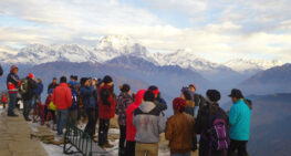
-Ghorepani Poon Hill 3210m: Famous for spectacular viewpoint offering panoramic sunrise views of Annapurna, Dhaulagiri, and Fishtail.
Cultural Diversity Along the Trek
The Annapurna Circuit passes through different ethnic regions, each with distinct traditions and lifestyles:
Gurung and Magar Communities in the Lower Regions, found in areas like Mesisahar, Dharapani, and Chame, are known for their warrior history and involvement in the British Gurkha Regiments.
Tibetan Buddhists were influenced by Tibetan culture with monasteries, prayer wheels, and Mani walls around the Manang and Mustang districts. Thakali people in Lower Mustang and Upper Mustang are known for their unique culture and delicious Thakali Cuisine, Monasteries, prayer Flags, and Chortens, Stupas can commonly be seen, making the trek a rich cultural experience.
Annapurna Circuit Trek weather and temperature variations:
-Lower elevations: Besisahar to Dharapani is warm during the day and cool at night.
–Mid-altitudes: Timang to Manang has moderate temperatures, but can be cold at night.
-High Altitude Thorong-la will be very cold, with strong winds and possible snow.
-Kali Gandaki Valley is very windy and dry, similar to a high-altitude desert.
The rapid gain in altitude makes proper acclimatization essential. Manang 3,500m is the most Common Acclimatization stop, with side hikes like Ice Lake, Gangapurna Glacier, or Hundred Cave to help with adaptation. Thorong La Pass, 5,416 meters, is the most challenging part due to altitude and weather conditions.
Accommodation and food:
The Annapurna Circuit Trek follows a teahouse trekking style, meaning you stay in local lodges instead of camping. Basic but comfortable rooms with shared bathrooms are common. In higher altitudes, facilities are more basic, with fewer amenities.
Dal Bhat (Rice, lentil soup, Vegetables) is a common and fresh food on the trekking trail.
Thukpa (Tibetan Noodle Soup), Momos (dumplings), and Tsampa Porridge (barley porridge) are popular in this trek
Meat is available but not recommended at high altitudes due to hygiene concerns. Similarly, you can find bread items, eggs, potatoes, and many local varieties.
Teahouses/ Lodges- The most common type of stay, offering basic rooms with twin beds, blankets, and a shared bathroom, is available all over the Tea Houses.
Luxury Lodges in lower regions like Chame, Manang, Muktinath, Jomsom, Tatopani, and Ghorepani offer hot showers, attached bathrooms, and WIFI.
Basis Teahouses in higher altitudes like Thorong Phedi and High Camp Lodges are simple, with shared dorm-style rooms and limited facilities. If you don’t want to stay in a major trekking Stop, you can find basic tea shops. Hot showers, electric device charges, and WIFI are extra charges in most places.
Local Buses, four four-wheel jeeps from Kathmandu to Besisahar, and jeeps to Dharapani or Chame. Returning from Muktinath to Tatopani will be by bus, and from Jomsom to Pokhara can fly.
Best Season/Time for Annapurna Circuit Trek:
The best Time for the Annapurna Circuit Trek is Spring, March to June, and Autumn, September to November. These months offer the best weather, clear mountain views, and comfortable trekking conditions.
1. Autumn, September-November – Best Season
-Stable Weather and clear skies- ideal for panoramic mountain views
-Calm temperatures, not too cold and not too hot.
-Festive Atmosphere- major Nepali festivals like Dashain and Tihar.
-More Crowded-popular routes can get busy
2. Spring (March-May) – Second-best Season for trekking
-Blooming Rhododendrons and Lush greenery, especially in the lower regions
-Clear Skies and good visibility- Though Occasional haze in lower areas.
-Mild temperatures – pleasant for Trekking.
-Pre-monsoon storms are possible but usually brief.
3. Winter (December – February) only for Experienced Trekkers
-Less Crowded -Quiet Trails.
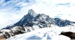
-Beautiful Snow-covered landscapes- stunning winter scenery with snow.
-Very Cold Temperatures -Especially at high Altitudes.
-Thorong – La pass may be closed due to heavy Snow.
4. Monsoon (June – August) – not recommended
– Fewer trekkers-less crowded trails
-Lush Green Scenery – The lower region is beautiful.
-Heavy rain and landslides – Trails can be Dangerous.
-Cloudy Weather – Limited Mountain Views.
-Leeches in lower elevations can be annoying.